

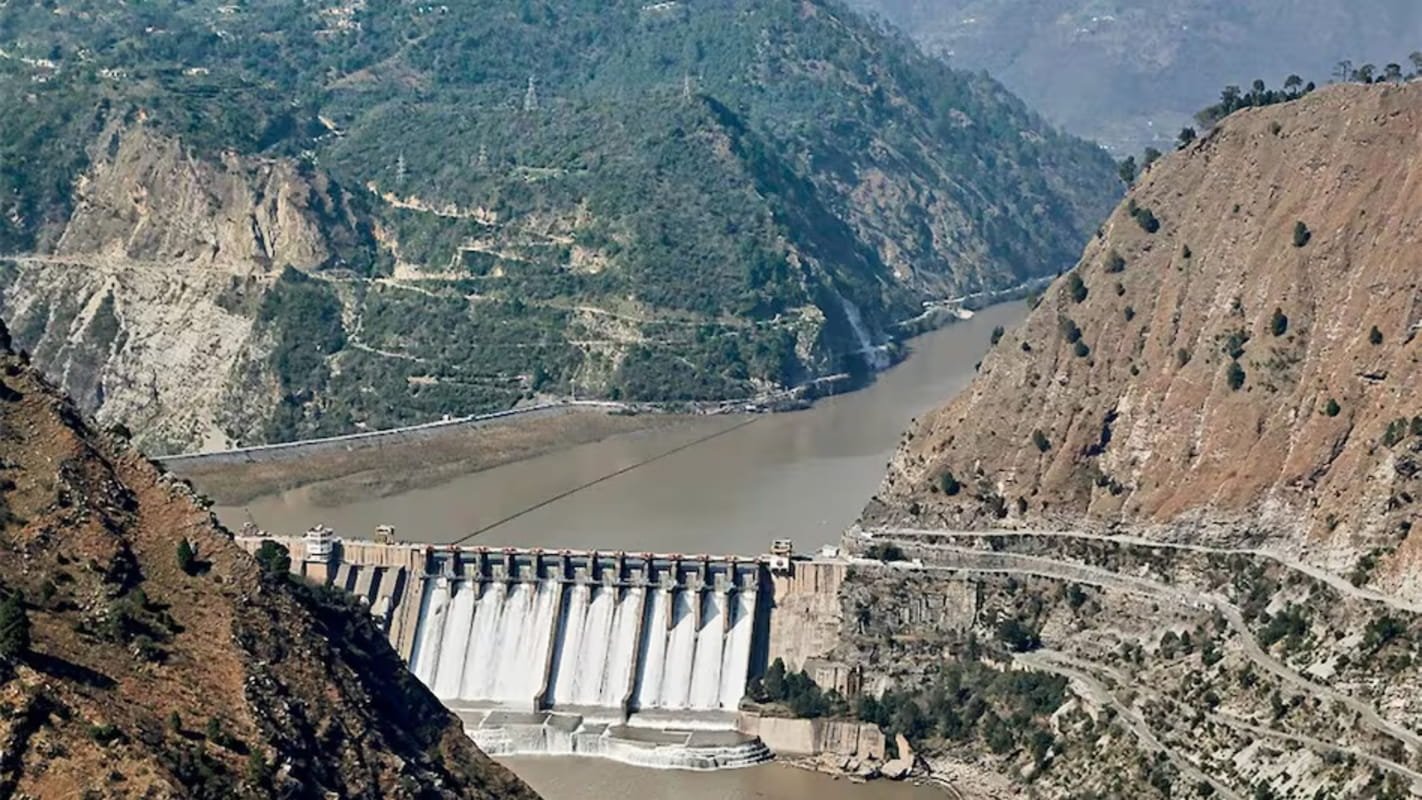
Salal Dam built on the Chenab River. India Today

India’s position on the IWT is consistent that the Treaty stands in abeyance in response to Pakistan’s continued sponsorship of cross-border terrorism. Pakistan must credibly and irrevocably abjure its support for cross-border terrorism.
The Indus Waters Treaty (IWT), signed in Karachi on September 19, 1960, has proved counterproductive. Historically, the Treaty allowed more than 80 per cent of the flows of the Indus River system to Pakistan and the remaining around 19.6 per cent to India. Though the Eastern Rivers were allocated to India, the Treaty restricted India’s ability to use the water of the Western Rivers (Indus, Jhelum, Chenab) optimally. The Treaty was used as a tool within the dispute-resolution mechanism to suppress the development of hydroelectric projects on the Western Rivers, thereby hampering the development of the Union Territories of Jammu and Kashmir and Ladakh.
On 22nd April 2025, terrorists, rogue elements and groups supported by Pakistan segregated and killed 26 people in Pahalgam, Kashmir, based on their religion. This direct action by Pakistan, with credible evidence of acting against India's supreme national security interests, forced India to hold the Treaty in abeyance.
India’s position on the IWT is consistent that the Treaty stands in abeyance in response to Pakistan’s continued sponsorship of cross-border terrorism. Pakistan must credibly and irrevocably abjure its support for cross-border terrorism.
The Rivers of the Indus Basin
As per the Indus Waters Treaty (IWT), three rivers, the Indus, Jhelum and Chenab, are classified as the ‘Western Rivers’, whereas the other three rivers, the Ravi, Beas, and Satluj, are designated as the ‘Eastern Rivers’. This Indus system ultimately discharges into the Arabian Sea south of Karachi.
The Indus River originates in Tibet (Mansarovar) near Demchok. It enters India upstream of Nimoo and exits at Batalik in Kargil district, near Skardu, into Pakistan-occupied Kashmir (PoK). The Satluj is another river that originates in Tibet from Mansarovar near Rakas Lake (Tal). It enters India at Shipkila and leaves India downstream of the Ferozepur Headworks.
The primary tributaries of the Indus System in India include the Jhelum, Satluj, Chenab, Ravi, Beas and Ghaggar rivers. While the Indus and Satluj rivers originate in Tibet, the remaining four major rivers originate within Indian territory. The River Jhelum leaves India near Chakothi on the Indian side and Muzaffarabad in PoK. The River Chenab and the River Ravi leave India near Akhnoor in Jammu district and at Goina/Kakarmani village of Amritsar district, respectively.
Imbalance in Water Distribution in the Indus Waters Treaty
After the signing of the Indus Waters Treaty (IWT), India was allowed exclusive use of the waters of the Eastern rivers, which were estimated at 40.7 BCM (billion cubic metres) or 33 MAF (million acres). Pakistan was allowed to utilise the full flow of the Western rivers, estimated at 168 to 170 BCM, or around 135 to 140 MAF. Ironically, India is allotted only around 19.6 per cent of the water share of the River Indus system through the Eastern rivers, even though it has almost double the catchment area for this share. On the other hand, Pakistan receives around 81 per cent of the water share of the Indus system, with around half of the catchment area for this share falling within Pakistan.
After the Partition, of the 143 canals in the undivided Punjab, only 12 came to East Punjab (India) and 131 to West Punjab (Pakistan). With partition, the Indus plains that came to India were much less developed than those that went to Pakistan.
According to the 1941 census, the population dependent on the waters of the Indus System was 25 million (54 per cent) in Pakistan and 21 million (46 per cent) in India. 46 per cent of the population on the Indian side received only 19.6 per cent of the water, whereas 54 per cent of the population in Pakistan received around 80 per cent of the water. Out of 26 million acres of irrigated land by the Indus canals, 21 million acres went to Pakistan, and only 5 million acres came to India. The newly imposed political environment after partition not only disrupted the food supply line but also severed the hydrological unity of the Indus system. It posed a serious threat to the development of several million acres of highly arid but otherwise fertile land in the Indian part of the Indus Basin.
Under the Treaty, Pakistan received a disproportionate and excessive allocation of water relative to its catchment area. This asymmetrical distribution stands in stark contrast to the Indian side, where the states of Punjab, Haryana, and Rajasthan, along with the National Capital Region of Delhi, face both chronic and acute water scarcity.
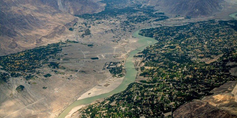
The confluence of the Jhanskar and Indus rivers in Ladakh is shown in Figure 1. The typical catchment of the Indus River in Ladakh is shown in Figure 2.
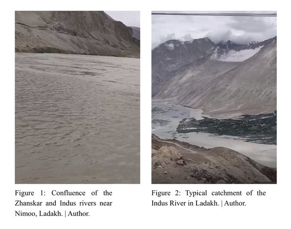
Confluence of the Jhanskar and Indus rivers, Ladakh
Water Crisis in Indian States: Punjab, Haryana, Rajasthan and Delhi
In the Indian state of Punjab, net dynamic ground water resources are 21.44 MCM (million cubic metres), whereas net draft (pumping of ground water) is 31.16 MCM, leading to a ground water deficit of 9.72 MCM each year. Thus, the stage of groundwater development for the Punjab state in India as a whole is 145 per cent, and the State falls under the “over- exploited” category. The groundwater table in most parts of Punjab is between 200 and 300 metres below the surface. Out of the State's area of about five million hectares (ha), 4.32 million hectares have severe groundwater levels. Similarly, the Indian State of Haryana (carved out of Punjab in 1966), with an area of 4.42 million hectares, is suffering badly and is under severe water stress. The state of Rajasthan receives only 83 millimetres of annual rainfall in its Jaisalmer district.
Haryana pumps out far more water than nature puts back. The Central Ground Water Board classifies numerous blocks in the state as "over-exploited". The water table in some districts of Haryana has fallen to as low as 200-300 feet.
Similarly, large stretches of land in Rajasthan, a state with many communities affected by high temperatures exceeding 50 degrees Celsius, are covered by desert dunes. Water availability for the survival of the State's growing population is under severe strain.
Indian states with interstate water conflicts plague the Indus Basin. Numerous court cases between these States over water disputes are pending before the Supreme Court of India. In addition, the region is characterised by a growing population and declining per capita water availability. The Indus Basin has a strong strategic role in the country's overall food security and socio-economic development. The states of Punjab and Haryana, accounting for four per cent of India’s total population, produce 25 per cent of the country’s total wheat production. The state of Punjab, known as the breadbasket of India, is facing a water crisis.
Post-Independence plans to divert water from the Chenab River into the Ravi and Beas basins could have prevented the acute water shortages these states are currently facing. Between 1949 and 1950, surveys and investigations were conducted in collaboration with foreign experts to construct a diversion dam near Marhu village in the Pangi sub-division of Chamba district in Himachal Pradesh. While designed to divert water from the Chenab River into the Ravi River basin, the project was ultimately shelved following the negotiations and subsequent signing of the Indus Waters Treaty. Had the dam been constructed, it would have minimised water scarcity and regional disputes between the North Indian states of Punjab, Haryana, Rajasthan and Delhi, fostering long-term economic prosperity across these states.
Losses Suffered by Jammu and Kashmir
A study carried out by an International Consulting Company in April 2019 indicated that Jammu and Kashmir (J&K) and Ladakh have suffered significant financial losses due to the signing of the IWT. Basically, IWT is viewed as a major bottleneck for the economic and infrastructural growth of the Union Territories of Jammu and Kashmir and Ladakh. The Treaty imposes severe restrictions on the development of water resources and hydropower projects on the Western Rivers (the Indus, Jhelum, and Chenab) that flow directly through these Union Territories.
Union Territories (UTs) of Jammu and Kashmir and Ladakh are rich in water resources. These UTs, however, face chronic power shortages during the winter. They have to buy power from short-term market arrangements or import from other States. Development of hydropower projects has suffered due to restrictions and a long-drawn dispute resolution mechanism under IWT. Pakistan has objected to all small and big water resources projects in these Union Territories.
The development of the agricultural sector in both of these UTs has been severely impacted by IWT. Total cultivated land, including wasteland, in the Union Territories (UTs) of Jammu and Kashmir and Ladakh is 17,591 square kilometres. Out of this, only 6,318 square kilometres are under irrigation so far. The area yet to be irrigated, including the wasteland area of 2,633 square kilometres, amounts to 11,273 square kilometres.
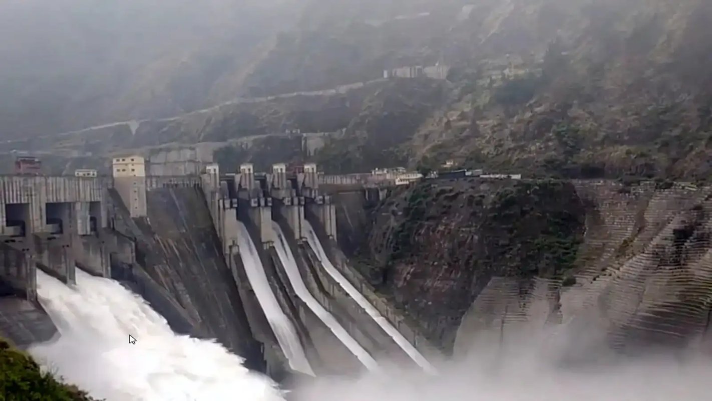
Under the Indus Waters Treaty (IWT), the permissible storage capacity allocated to India on the Western rivers is limited to 3.6 MAF. Consequently, major run-of-the-river hydroelectric projects such as Salal, Baglihar, and Kishanganga have suffered severe siltation in their small reservoirs. This rapid accumulation of sediment in these reservoirs is driven by Treaty-imposed design restrictions that prohibit the construction of low-level sluice gates, preventing India from conducting necessary sediment flushing and sluicing operations.
For sustainable sediment management of Himalayan rivers with steep gradients, there is no alternative to installing low-level sluice gates to carry out sediment sluicing. Provisions under IWT for installing floodgates near the top of the dam are unsustainable, as has been experienced at the Salal and Baglihar Dams.
Similarly, Pakistan objected to the construction of the Tulbul Navigation Project in March 1985. In a goodwill gesture to foster productive dialogue, India suspended work in September 1987 for an initial three-month period. Following two rounds of Secretary-level talks, India agreed to an additional three-month delay, followed by two subsequent one-month extensions that stretched the suspension to June 2, 1988. After five rounds of high-level negotiations, India acceded to Pakistan’s request for an indefinite suspension of the project pending an amicable settlement. Further discussions without reaching any conclusion were held from November 1998 to March 2012, serving as a fair indication of Pakistan’s intent to drag out the issue to ensure the work remains permanently suspended.
It is pertinent to mention that regulating the water of Wular Lake on the Jhelum River in the Kashmir valley through a Navigation Lock, in addition to improving navigation on the Jhelum River, would have immensely benefited Pakistan as well.
During the pre-Independence era, approximately 70 per cent of the total cargo in the Kashmir Valley was transported by large traditional wooden boats, locally known as ‘khachus’, with a carrying capacity of up to 15 tonnes and historically operated by Hanji (local boatmen). Tulbul Navigation Lock, through regulated releases, would have restored year-round navigation on the Jhelum River up to Baramulla. It would also have improved tourism activities in the Kashmir valley.
Similarly, if the IWT were not in place, part of the floodwaters in the Jhelum River would have been diverted into a natural drainage system upstream of Srinagar, thereby preventing severe floods like the one that devastated Srinagar city in 2014.
According to a detailed study, the annual losses suffered by the Union Territories (UTs) of Jammu and Kashmir and Ladakh due to the restrictive provisions of the IWT were estimated at USD 386 million at the 2019 price level. Adjusted to today's price levels, these annual losses amount to approximately USD 506 million (about ₹4,830 crore). Given these figures, the cumulative loss suffered by these UTs over nearly 65 years from 1960 to 2025 is staggering. Himachal Pradesh, having huge hydroelectric power potential in the River Chandra Bhaga, would have suffered similar losses.
Conclusion
The asymmetric provisions of the IWT have severely constrained the northern Indian states of Punjab, Haryana, Himachal Pradesh, Rajasthan, and Delhi, as well as the Union Territories of Jammu and Kashmir and Ladakh. The Treaty's restrictive framework has heavily hindered irrigation development and hydroelectric generation across these regions. Furthermore, technical issues surrounding sediment management, operation, and maintenance have frequently been leveraged by Pakistan through the Treaty’s dispute resolution mechanisms to delay the construction of most hydroelectric projects.
While the economic ramifications for Jammu and Kashmir and Ladakh have been quantified, the financial losses incurred by Himachal Pradesh remain unassessed. This is particularly impactful for the huge potential of hydroelectric power projects along the Chandra Bhaga (Chenab) River, which originates in Himachal Pradesh before crossing into Jammu and Kashmir at Sansari Nallah in the Pangi sub-division. As a result, even Himachal Pradesh continues to endure substantial unquantified annual losses directly tied to the Treaty's limitations.
The Indus Basin has thus become a unique global anomaly, where an upper riparian state is deprived of its natural right to utilise its own rivers. Furthermore, it is restricted from employing modern engineering techniques to construct dams on rivers flowing through its territory to meet the basic water demands and energy requirements of its population.
[The article is exclusive to NatStrat. The views expressed by the author(s) are personal and do not necessarily reflect the views of the organisation.]
Separating Reality from the Rhetoric: Facts, Fiction, and the Indus Waters Treaty