Mansarovar Lake

This article is part of a three-part series by Pradeep Kumar Saxena and Teerath Singh Mehra who discuss India-China relations through the lens of water management. In this first part, the authors provide a framework of cooperation for flood management.
PART I: INTRODUCTION
In a significant diplomatic breakthrough during Foreign Secretary Shri Vikram Misri's visit to China during 26-27 January 2025, both countries comprehensively reviewed bilateral relations and agreed to implement people-centric measures to stabilise and rebuild ties. A notable development was the announcement to convene an early meeting of the India-China Expert Level Mechanism (ELM) to discuss the resumption of hydrological data-sharing and other trans-border river initiatives.
Over recent decades, the relations between India and China have gradually improved through sustained high-level diplomatic visits and exchanges. The ELM on trans-border rivers exemplifies this cooperation, providing a framework for managing shared water resources between the two nations. The resumption of this mechanism marks a crucial step in water sector cooperation between India and China, potentially contributing toward normalising relations between these Asian powers.
The Physiography of the Tibetan Plateau
The Tibetan Plateau serves as Asia's critical watershed, earning its nickname "The Water Tower of Asia." Four major river basins - the Indus, Ganga, Brahmaputra and Meghna - flow through South Asia, connecting India, Bangladesh, Pakistan, Nepal, Bhutan and China in a complex hydrological network. While China lies outside South Asia's traditional boundaries, its position as an upper riparian state controlling Tibet's water resources makes it a pivotal player in regional water dynamics. Tibet's rivers sustain not only South Asian nations but also Southeast Asian countries including Myanmar, Thailand, Laos, Cambodia and Vietnam. Notably, Tibet provides 30 per cent of China's freshwater supply, underscoring the plateau's strategic importance in Asian water security.
The trans-border rivers flowing from Tibet to India fall into two main groups, namely the Brahmaputra River system on the Eastern side which consist of Siang River (mainstream of Brahmaputra) and its tributaries coming from Tibet and the Indus River system on the West consists of Indus River and the Sutlej River. The Brahmaputra River System assumes greater significance in the India-China water context and assumes focus at present.
The Majestic Brahmaputra: A Trans-Continental Journey
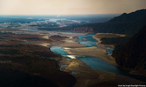
The Brahmaputra River begins its course as the Siang River from the Ansi Glacier near Manasarovar Lake in Southwest Tibet, at an altitude of 5,300 m. In Tibet, where it is known as the Yarlung Zangbo or Tsangpo, the river flows for 1,700 km before entering India's Arunachal Pradesh, near Gelling.
Before entering Arunachal Pradesh, the river makes a U-turn around Namcha Barwa mountain, which is called the Brahmaputra's Great Bend. It then descends through steep gorges for 226 km until reaching Pasighat at 152 m elevation. Further flowing 52 km, the Siang converges with two major rivers, the Lohit and the Dibang, near Sadiya in Assam at 123m elevation. This confluence forms the mighty Brahmaputra, which continues its journey for 642 km through Assam and another 260 km in Bangladesh, where it is known as the Jamuna, before finally emptying into the Bay of Bengal.
The Brahmaputra's vast basin encompasses 580,000 km2 up to its confluence in Bangladesh. This area is distributed across several countries: 293,000 km2 in China's Tibet Autonomous Region, 194,413 km2 in India, 45,587 km2 in Bhutan and 47,000 km2 in Bangladesh.
The river system is fed by numerous tributaries from both sides. The right bank tributaries include the Lohit, Dibang, Subansiri, Ronganadi, Jiabharali, Dhansiri, Manas, Torsa, Sankosh and Teesta. These tributaries are characterised by steep slopes and are prone to flash flows. The left bank tributaries comprise the Noadehing, Burhidihing, Desang, Dikhow, Dhansiri, Kopili, Kulsi, Krishnai, Dudhnoi and Jinjiran, which generally feature more gradual gradients.
The basin's hydrology is primarily influenced by the Southwest monsoon, with 85 per cent of the total annual rainfall occurring during the monsoon months from May to September. This concentrated rainfall pattern significantly affects the river's flow and the surrounding ecosystem.
India-China Cooperation: Evolving Framework for Flood Management
Brahmaputra Basin
The Brahmaputra
The catastrophic floods of 2000 highlighted the critical need for cross-border early warning systems which led to signing of a Memorandum of Understanding (MoU) establishing a framework for sharing crucial flood-related data during monsoon seasons.
Under this MoU, China agreed to share the information limited to rainfall, water level and discharge data-sharing twice a day during flood seasons from three strategic stations in Tibet: Nugesha, Yangcun and Nuxia during June to October each year. The agreement was renewed for five-year terms in 2008, 2013 and 2018. In October 2018, China promptly reported a landslide-induced blockage downstream of Nuxia and maintained hourly observation updates. This incident showcased the potential benefits of bilateral cooperation in managing river-related emergencies. As of June 2023, the MoU has expired, and both nations are currently working through diplomatic channels to negotiate its renewal.
Sutlej Basin
Following the catastrophic 2004 breach in Parichu Lake, an MoU of 2005 was developed to provide vital hydrological information about the Sutlej River (Langqen Zangbo) during the flood seasons. Under this MoU, China established monitoring at Tsada station with twice-daily data transmission of hydrological information limited to rainfall, water level and discharge data-sharing twice a day during flood seasons from June to October. This MoU was renewed for five years in 2010 and for another five years in 2015. The MoU expired in 2020, and efforts are ongoing for its renewal through diplomatic channels.
Both the MoUs on Brahmaputra and Sutlej require India to finance the data collection through annual advance payments to China and include provisions for the immediate notification of abnormal water conditions on a near real-time basis. These agreements demonstrate constructive trans-boundary water management through sustained diplomatic engagement and technical cooperation.
However, these collaborations have not been without their challenges. The data-sharing mechanism has experienced periodic disruptions, particularly in the time of tense relations, highlighting the complex nature of transboundary water management.
Umbrella Memorandum of Understanding
In 2013, both nations signed a comprehensive "Memorandum of Understanding on Strengthening Cooperation on Trans-Border Rivers." This agreement expanded the hydrological information sharing period by fifteen days from the previous 1 June-15 October timeframe to 15 May-15 October. Unlike previous agreements, this umbrella MoU has no expiration date and establishes a framework for broader water sector cooperation. Currently, no further active initiatives could be implemented under this MoU.
Implementation Plans for Hydrological Data: A Comprehensive Framework
In a two-step process, the MoUs for both the Brahmaputra and Sutlej Rivers are then operationalised through detailed Implementation Plans (IPs). The IPs function as detailed operational frameworks that specify the technical aspects of hydrological data-sharing between India and China. These comprehensive documents outline critical operational elements including data transmission methods, financial arrangements and technical specifications. As part of this collaborative framework, India maintains transparency by informing Chinese authorities about how the shared hydrological data contributes to flood forecasting models and mitigation strategies.
The MoUs promote knowledge exchange through reciprocal expert study tours, enabling specialists from both countries to observe and learn from each other's water management approaches. On India's side, the Central Water Commission (CWC) acts as the designated official signatory for these Implementation Plans, ensuring consistent representation. (End of Part I. Parts II and III to follow)
(Exclusive to NatStrat)